


Flood Watch 2019
The EHS-hub took a deeper look into potential flooding for 2019
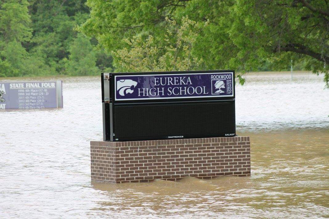
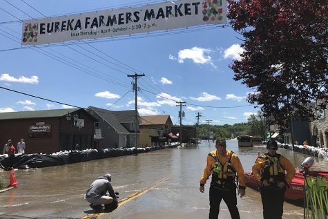
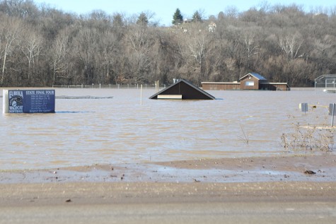
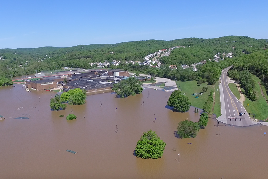
Rising flood waters, close the EHS and later the district, May 1. AP testing will resume, May 5, at the Annex regardless of the flooding at the high school.
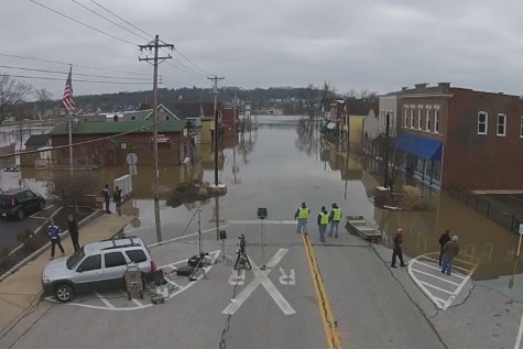
Even the slightest mention of the word “flood” brings back vivid memories for Eureka residents.
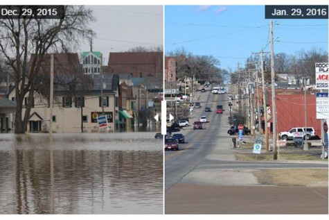
During record-breaking floods of December 2015 and May 2017, hundreds of members of the community were surprised to find that their houses were in harm’s way.
“I remember that I was out of town when all the rain started and when I came back I didn’t think it was going to be as bad as it was,” Ella Jerina (10) said.
Former P.E. Teacher and Coach Sharon Wasson never expected her home to be affected.
“People I talked to that were there in the ‘93 floods and the ‘80s floods said ‘Our houses never flood,’” Wasson said. “Then I opened the doors to my downstairs which is my family room, my office, my laundry room, and water was climbing up the stairs.”
Cleaning up such an event was not only exhausting for Wasson, but also heartbreaking.
“My husband passed away in ‘97 of ALS,” Wasson said. “I can remember picking up a box of all his things that we’d saved and the whole bottom just dropped out and they were destroyed. It was really emotional.”
Fortunately, 2015 flooding created a much more prepared Eureka community when the 2017 flood hit. Wasson and her crew created a contraption made of pipes and a trash can that they used to flush water out of her house.
“When we started seeing the flood levels, the football team came over,” Wasson said. “We literally stayed all night long just sucking up water.”
The community also came together to assist in sandbagging.
“I actually went to Ms. Wasson’s house and helped her move some stuff out of there,” Brandon Shipley (12) said. “Her basement was flooding and it was all going sideways so we were like ‘We’ve got to help her out.’”
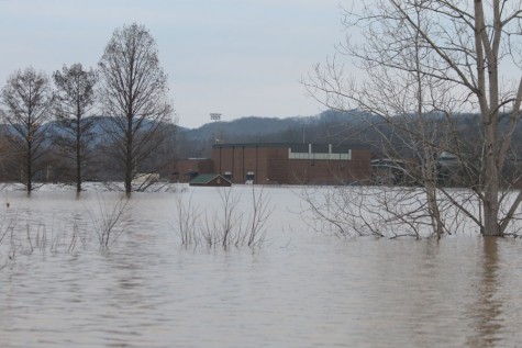
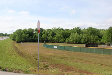
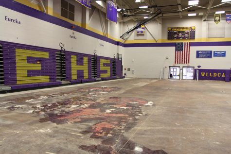
Floodwaters climbed high enough to cover the front soccer field and baseball fields at EHS, and even made it past the wall of sandbags and into the gym.
“The fields were all covered in water and before we had to do a bunch of sandbagging,” Josh Wetzel (11) said. “We had to take all the football equipment and move it up to higher places.”
Eureka residents praise the spirit of the community in a time of tragedy.
“It felt really good,” Jillian Oligschlaeger (11) said. “Even though the school flooded still, I like that I was able to help them.”
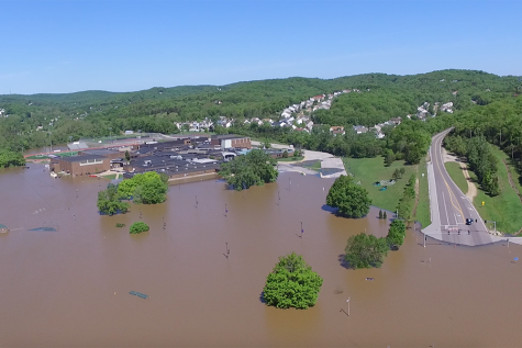
But the best alternative to flood preparation is prevention, which is imperative as flooding in the St. Louis area becomes more common.
This spring, the Meramec River is not expected to bring major flooding. However, Missourians have already felt the impact of high water levels in the Mississippi and Missouri rivers.
Farmers living along both rivers have had to deal with their farmland flooding, but fortunately the water hasn’t reached any commercial areas near St. Louis.
ABC 17 (Columbia, Mo.) Chief Meteorologist Jessica Quick believes that heavy snowfall up north has the potential to produce flooding in Missouri through June.
“Parts of the upper Midwest have seen record or near-record snowfalls this winter, and that coupled with recent heavy rain events exacerbates the problem,” Quick said.
The Mississippi River at Alton, Grafton, Winfield and other northern areas have a 50-90 percent chance of having major flooding, meaning that infrastructure damage is much more severe and some residents may even have to evacuate. In St. Louis, the Mississippi has a 92 percent chance of moderate flooding, according to Quick.
The causes of more frequent flooding are anything from heavier rain patterns to inadequate maintenance of levees. Across the United States, the amount of heavy precipitation has been above average since 1991, according the National Climate Assessment.
This is in part due to warmer surface temperatures on earth. The average temperature has increased 1.62 degrees since the 1800s, according to the National Aeronautics and Space Administration. Warm air can hold more water vapor, therefore leading to rainfall.
The extensive 100,000 miles of levees throughout the United States are also hard to manage. Levees are built by the U.S. Army Corps of Engineers and are supposed to be maintained by each individual city, county or district. However, there is no technical assessment of the performance or condition of the levees because districts must apply for a permit in order to alter them.
Most levees are around 50 years old and protect over $1.3 trillion in property. But the current system was given a “D” rating by the American Society of Civil Engineers in their 2017 report.
With the United States in need of $80 billion over the next ten years to improve and maintain its system of levees, floods will only become more common, according to the ASCE.
Data has also been released revealing that levee height has played a part in flooding, specifically in Missouri and Illinois. The USACE surveyed levee heights in the Rock Island District and found that 40 percent of the levees exceeded the standards.
Incorrect levee height becomes an issue when trapped water has no place to escape and is forced into other towns and communities.
“As one area tries to protect themselves from flooding, the adjacent communities or rural areas feel the affects,” Quick said. “The levee in Valley Park was built to a 500 year flood level when it was supposed to be a 100-year levee. That could have contributed to the problems in communities along the Meramec River in early 2016.”
Towns including Arnold, Eureka, Fenton and Kirkwood all suffered at the hands of the Valley Park levee in 2017. It was built five feet too high, which meant that the excess water it trapped spilled into surrounding communities.
Fortunately, a plan in in store for these flood-prone areas.
The Lower Meramec Floodplain Management Program is currently underway, with goals to create a plan for these flood-prone communities in the lower Meramec basin and provide recommendations to prevent future disasters.
Project Manager Harold Graef says the USACE plans to help towns including Arnold, Sunset Hills, Fenton, Valley Park, Wildwood, Eureka, Pacific and Union, as well as St. Louis, Jefferson and Franklin Counties.
“The floodplain management plan will look at a number of flood risk management measures- some physical, such as structure elevations, relocations, buyout/acquisition, wet flood-proofing, and dry flood-proofing,” Graef said. “Examples of non-physical measures include flood warning systems, flood insurance, floodplain mapping, flood inundation mapping, flood emergency preparedness plans, land use regulations, evacuation plans and risk communication.”
The final report is not yet available to the public, but it is a hopeful solution to the problem of flooding in Eureka.
Flooding is a developing issue throughout the Midwest as levees age and weather patterns fluctuate, but it’s clear that Eureka is prepared for anything.
“Eureka is the best town in the world,” Wasson said. “This town pulls together like no other.”
Your donation will support the student journalists of Eureka High School - MO. Your contribution will allow us to purchase equipment and cover our annual website hosting costs.

This is Brown's first semester on staff where she serves as a reporter for the EHS-hub. Brown enjoys playing soccer, hanging out with friends, and...